This is a collection of true felt stories, poems, news, ramblings and musings from Marinduquenos all over the world and other miscellaneous topics close to my heart.
Welcome and Mabuhay
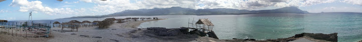
If you love Marinduque and want to contribute articles to this site, please do so. My contact information is in my profile. The above photo was taken from the balcony of The Chateau Du Mer Beach House, Boac, Marindque, Philippines. I love sunsets. How about you? Some of the photos and videos on this site, I do not own. However, I have no intention on infringing your copyrights. Thank you and Cheers!
The Redwood National and State Parks (RNSP) are located in the United States, along the coast of northern California. Comprising Redwood National Park (created 1968) and California's Del Norte Coast, Jedediah Smith, and Prairie Creek Redwoods State Parks (dating from the 1920s), the combined RNSP contain 133,000 acres (540 km2).[2] Located entirely within Del Norte and Humboldt Counties, the four parks, together, protect 45% of all remaining Coastal Redwood (Sequoia sempervirens) old-growth forests, totaling at least 38,982 acres (157.75 km2). These trees are the tallest and one of the most massive tree species on Earth. In addition to the redwood forests, the parks preserve other indigenous flora, fauna, grassland prairie, cultural resources, portions of rivers and other streams, and 37 miles (60 km) of pristine coastline.
In 1850, old-growth redwood forest covered more than 2,000,000 acres (8,100 km2) of the California coast. The northern portion of that area, originally inhabited by Native Americans, attracted many lumbermen and others turned gold miners when a minor gold rush brought them to the region. Failing in efforts to strike it rich in gold, these men turned toward harvesting the giant trees for booming development in San Francisco and other places on the West Coast. After many decades of unobstructed clear-cut logging, serious efforts toward conservation began. By the 1920s the work of the Save-the-Redwoods League, founded in 1918 to preserve remaining old-growth redwoods, resulted in the establishment of Prairie Creek, Del Norte Coast, and Jedediah Smith Redwoods State Parks among others. Redwood National Park was created in 1968, by which time nearly 90% of the original redwood trees had been logged. The National Park Service (NPS) and the California Department of Parks and Recreation (CDPR) administratively combined Redwood National Park with the three abutting Redwood State Parks in 1994 for the purpose of cooperative forest management and stabilization of forests and watersheds as a single unit.
The ecosystem of the RNSP preserves a number of threatened animal species such as the Brown Pelican, Tidewater Goby, Bald Eagle, Chinook Salmon, Northern Spotted Owl, and Steller's Sea Lion. In recognition of the rare ecosystem and cultural history found in the parks, the United Nations designated them a World Heritage Site on September 5, 1980 and an International Biosphere Reserve on June 30, 1983.
Note: This is No.22 of a series of articles on national park in the US.
Petrified Forest National Park is a U.S. national park in Navajo and Apache counties in northeastern Arizona, United States. The park's headquarters are about 26 miles (42 km) east of Holbrook along Interstate 40 (I-40), which parallels a railroad line, the Puerco River, and historic U.S. Route 66, all crossing the park roughly east–west. Named for its large deposits of petrified wood, the park covers about 146 square miles (380 km2), encompassing semi-desert shrub steppe as well as highly eroded and colorful badlands. The site, the northern part of which extends into the Painted Desert, was declared a National Monument in 1906 and a national park in 1962.
About 600,000 people visit the park each year and take part in activities including sightseeing, photography, hiking, and backpacking.
Averaging about 5,400 feet (1,600 m) in elevation, the park has a dry windy climate with temperatures that vary from summer highs of about 100 °F (38 °C) to winter lows well below freezing. More than 400 species of plants, dominated by grasses such as bunchgrass, blue grama, and sacaton, are found in the park. Fauna include larger animals such as pronghorns, coyotes, and bobcats; many smaller animals such as deer mice; snakes; lizards; seven kinds of amphibians, and more than 200 species of birds, some of which are permanent residents and many of which are migratory. About half of the park is designated wilderness.
The Petrified Forest is known for its fossils, especially fallen trees, that lived in the Late Triassic, about 225 million years ago. The sediments containing the fossil logs are part of the widespread and colorful Chinle Formation, from which the Painted Desert gets its name. Beginning about 60 million years ago, the Colorado Plateau, of which the park is part, was pushed upward by tectonic forces and exposed to increased erosion. All of the park's rock layers above the Chinle, except geologically recent ones found in parts of the park, have been removed by wind and water. In addition to petrified logs, fossils found in the park have included Late Triassic ferns, cycads, ginkgoes, and many other plants as well as fauna including giant reptiles called phytosaurs, large amphibians, and early dinosaurs. Paleontologists have been unearthing and studying the park's fossils since the early 20th century.
The park's earliest human inhabitants arrived at least 8,000 years ago. By about 2,000 years ago, they were growing corn in the area and shortly thereafter building pit houses in what would become the park. Later inhabitants built above-ground dwellings called pueblos. Although a changing climate caused the last of the park's pueblos to be abandoned by about 1400 CE, more than 600 archeological sites, including petroglyphs, have been discovered in the park. In the 16th century, Spanish explorers visited the area, and by the mid-19th century a U.S. team had surveyed an east–west route through the park and noted the petrified wood. Later roads and a railway followed similar routes and gave rise to tourism and, before the park was protected, to private removal of the park's fossils. Theft of petrified wood remains a problem in the 21st century. The Tepees
Note: This is No.21 of a series of articles on national park in the US.
Olympic National Park,Coastal Region-Pacific Coastline Olympic National Park is located in the U.S. state of Washington, in the Olympic Peninsula. The park can be divided into three basic regions: the Pacific coastline, the Olympic Mountains, and the temperate rainforest. U.S. President Theodore Roosevelt originally created Mount Olympus National Monument in 1909 and after Congress voted to authorize a re-designation to National Park status, President Franklin Roosevelt signed the legislation in 1938. In 1976, Olympic National Park became an International Biosphere Reserve, and in 1981 it was designated a World Heritage Site. In 1988, Congress designated 95 percent of the park as the Olympic Wilderness.
Mount Olympus on Winter The Rain Forests
This is No.20 of a series of articles on national parks in the US.
Mt Rainier as viewed from Paradise, Washington Mount Rainier National Park is a United States National Park located in southeast Pierce County and northeast Lewis County in Washington state. It was one of the US's earliest National Parks, having been established on March 2, 1899 as the fifth national park in the United States. The park contains 368 square miles (950 km2) including all of Mount Rainier, a 14,411-foot (4,392 m) stratovolcano. The mountain rises abruptly from the surrounding land with elevations in the park ranging from 1,600 feet (490 m) to over 14,000 feet (4,300 m). The highest point in the Cascade Range, around it are valleys, waterfalls, subalpine wildflower meadows, old growth forest and more than 26 glaciers. The volcano is often shrouded in clouds that dump enormous amounts of rain and snow on the peak every year and hide it from the crowds that head to the park on weekends.
Mount Rainier is circled by the Wonderland Trail and is covered by several glaciers and snowfields totaling some 35 square miles (91 km2). Carbon Glacier is the largest glacier by volume in the continental United States, while Emmons Glacier is the largest glacier by area. About 1.3 million people visit Mount Rainier National Park each year. Mount Rainier is a popular peak for mountain climbing with some 10,000 attempts per year with approximately 25% making it to the summit. The park contains outstanding subalpine meadows and 91,000 acres (370 km2) of old growth forests.
This is No.19 of a series of articles on national parks in the US.
Mammoth Cave National Park is a U.S. National Park in central Kentucky, encompassing portions of Mammoth Cave, the longest cave system known in the world. The official name of the system is the Mammoth-Flint Ridge Cave System for the ridge under which the cave has formed. The park was established as a national park on July 1, 1941. It became a World Heritage Site on October 27, 1981, and an international Biosphere Reserve on September 26, 1990.
The park's 52,835 acres (21,382 ha) are located primarily in Edmonson County, Kentucky, with small areas extending eastward into Hart County and Barren County. It is centered around the Green River, with a tributary, the Nolin River, feeding into the Green just inside the park. With over 390 miles (630 km) of passageways it is by far the world's longest known cave system, being well over twice as long as the second longest cave system, which is South Dakota's Jewel Cave with just over 150 miles (240 km) of known passageways.
This is No. 18 of the series of articles on national park in the US.
Lassen Volcanic National Park is a United States National Park in northeastern California. The dominant feature of the park is Lassen Peak; the largest plug dome volcano in the world and the southern-most volcano in the Cascade Range. Lassen Volcanic National Park started as two separate national monuments designated by President Theodore Roosevelt in 1907: Cinder Cone National Monument and Lassen Peak National Monument.
The source of heat for volcanism in the Lassen area is subduction off the Northern California coast of the Gorda Plate diving below the North American Plate. The area surrounding Lassen Peak is still active with boiling mud pots, stinking fumaroles, and churning hot springs. Lassen Volcanic National Park is one of the few areas in the world where all four types of volcano can be found (plug dome, shield, cinder cone, and strato). The park is accessible via State Routes SR 89 and SR 44. SR 89 passes north-south through the park, beginning at SR 36 to the south and ending at SR 44 to the north. SR 89 passes immediately adjacent the base of Lassen Peak.
There are a total of five vehicle entrances to the park: the north and south entrances of SR 89, and unpaved roads entering at Drakesbad and Juniper Lake in the south, and Butte Lake in the northeast. The Park can also be accessed by trails leading in from Caribou Wilderness to the east, as well as the Pacific Crest Trail, and two smaller trails leading in from Willow Lake and Little Willow Lake to the south. Mt Shasta as seen from Lassen National Park A large lodge (the Lassen Chalet) with concession facilities formerly was located near the south-west entrance, but was demolished in 2005. A new, full-service visitor center was constructed in the same location, and opened to the public in 2008. Near the old lodge location was also located Lassen Ski Area, which ceased operation in 1992; all infrastructure has been removed.
This is No.17 of the series of articles on national park in the US.
Kings Canyon National Park is a U.S. National Park in the southern Sierra Nevada, east of Fresno, California. The park was established in 1940 and covers 462,901 acres (187,329 ha). It incorporated General Grant National Park, established in 1890 to protect the General Grant Grove of Giant Sequoias.The park is north of and contiguous with Sequoia National Park; the two are administered by the National Park Service together. Kings Canyon had been known to white settlers since the mid-19th century, but it was not until John Muir first visited in 1873 that the canyon began receiving attention. Muir was delighted at the canyon's similarity to Yosemite Valley, as it reinforced his theory regarding the origin of both valleys, which, though competing with Josiah Whitney's then-accepted theory that the spectacular mountain valleys were formed by earthquake action, Muir's theory later proved correct: that both valleys were carved by massive glaciers during the last Ice Age.
Then United States Secretary of the Interior Harold Ickes fought to create the Kings Canyon National Park. He hired Ansel Adams to photograph and document this among other parks, in great part leading to the passage of the bill in March 1940. The bill combined the General Grant Grove with the back country beyond Zumwalt Meadow. Kings Canyon's future was in doubt for nearly fifty years. Some wanted to build a dam at the western end of the valley, while others wanted to preserve it as a park. The debate was settled in 1965, when the valley, along with Tehipite Valley, was added to the park.
Note: This is No. 16 of a series of articles on popular national parks in the US. Macrine and I with the Katague children visited these two parks in the late 1970's.
Joshua Tree National Park is located in southeastern California. Declared a U.S. National Park in 1994 when the U.S. Congress passed the California Desert Protection Act (Public Law 103-433), it had previously been a U.S.National Monument since 1936. It is named for the Joshua tree (Yucca brevifolia) forests native to the park. It covers a land area of 789,745 acres (319,598 ha). A large part of the park is designated to wilderness area—some 429,690 acres (173,890 ha). Straddling the San Bernardino County/Riverside County border, the park includes parts of two deserts, each an ecosystem whose characteristics are determined primarily by elevation: the higher Mojave Desert and lower Colorado Desert. The Little San Bernardino Mountains run through the southwest edge of the park.
This is No.15 of a series of articles on popular national parks in the US.
Hawaiʻi Volcanoes National Park, established in 1916, is a United States National Park located in the U.S. State of Hawaiʻi on the island of Hawaiʻi. It displays the results of hundreds of thousands of years of volcanism, migration, and evolution—processes that thrust a bare land from the sea and clothed it with complex and unique ecosystems and a distinct Ancient Hawaiian culture. Kīlauea, one of the world's most active volcanoes, and Mauna Loa, the most massive, offer scientists insights on the birth of the Hawaiian Islands and visitors' views of dramatic volcanic landscapes. In recognition of its outstanding natural values, Hawaiʻi Volcanoes National Park has been designated as an International Biosphere Reserve in 1980 and a World Heritage Site in 1987.
The park includes 505.36 square miles (1,308.9 km2) of land. Over half of the park is designated the Hawaii Volcanoes Wilderness area and provides unusual hiking and camping opportunities. The park encompasses diverse environments that range from sea level to the summit of the Earth's most massive volcano, Mauna Loa at 13,677 feet. Climates range from lush tropical rain forests, to the arid and barren Kaʻū Desert. Active eruptive sites include the main caldera of Kīlauea and a more active but remote vent called Puʻu ʻŌʻō. The main entrance to the park is from the Hawaii Belt Road. The Chain of Craters Road, as the name implies, leads past several craters from historic eruptions to the coast. It used to continue to another entrance to the park near the town of Kalapana, but that portion is now covered by a lava flow.
Note: This is No.14 of the series of articles on popular national parks in the US. Macrine and I visited this park in 2007.
Grand Teton National Park is a United States National Park located in northwestern Wyoming, south of Yellowstone National Park. The park is named after the Grand Teton, which, at 13,770 feet (4,197 m), is the tallest mountain in the Teton Range. The origin of the name "Teton" is not definitive. One possible origin is that it was the name given by French trappers in the area. ("Tetons" means breasts in French) Another possible source is that the mountains derive their name from the names of one of tribes in the Sioux Nation. Grand Teton National Park was established on February 26, 1929. The park covers 484 square miles (1,250 km2) of land and water. There are nearly 200 miles (320 km) of trails for hikers to enjoy in Grand Teton National Park.
The rock units that make up the east face of the Teton Range are around 2500 million years old and made of metamorphosed sandstones, limestones, various shales, and interbeded volcanic deposits. Buried deep under Tertiary volcanic, sedimentary, and glacial deposits in Jackson Hole, these same Precambrian rocks are overlain by Paleozoic and Mesozoic formations that have long since been eroded away from atop the Tetons.
The Paleozoic-aged sediments were deposited in warm shallow seas and resulted in various carbonate rocks along with sandstones and shales. Mesozoic deposition transitioned back and forth from marine to non-marine sediments. In later Mesozoic, the Cretaceous Seaway periodically covered the region and the Sierran Arc to the west provided volcanic sediments.
A mountain-building episode called the Laramide orogeny started to uplift western North America 70 million years ago and eventually formed the Rocky Mountains. This erased the seaway and created fault systems along which highlands rose. Sediment eroded from uplifted areas filled-in subsiding basins such as Jackson Hole while reverse faults created the first part of the Teton Range in the Eocene epoch. Large Eocene-aged volcanic eruptions from the north in the Yellowstone-Absaroka area along with later Pleistocene-aged Yellowstone Caldera eruptions, left thick volcanic deposits in basins.
The Teton Range started to grow along a north-south trending fault system next to Jackson Hole some 9 million years ago in the Miocene epoch. Then starting in the Pliocene, Lake Teewinot periodically filled Jackson Hole and left thick lakebed sediments. The lake was dry by the time a series of glaciations in the Pleistocene epoch saw the introduction of large glaciers in the Teton and surrounding ranges. During the Last Glacial Maximum, these glaciers melded together to become part of the Wisconsin glaciation, which carried away all soil from Jackson Hole and surrounding basins. Later and less severe ice ages created enough locally-deposited material in the form of moraines and till to repair much of this damage. Since then, mass wasting events such as the 1925 Gros Ventre landslide, along with slower forms of erosion, have continued to modify the area. On the floor of the Jackson Hole valley rise several landforms, one of the most conspicuous being Blacktail Butte.
Note: This is No.13 of the series of articles on national parks in the US.
Glacier National Park is located in the U.S. state of Montana, bordering the Canadian provinces of Alberta and British Columbia. The park encompasses over 1,000,000 acres (4,000 km2) and includes parts of two mountain ranges (sub-ranges of the Rocky Mountains), over 130 named lakes, more than 1,000 different species of plants and hundreds of species of animals. This vast pristine ecosystem is the centerpiece of what has been referred to as the "Crown of the Continent Ecosystem", a region of protected land encompassing 16,000 square miles (41,000 km2).
The region that became Glacier National Park was first inhabited by Native Americans and upon the arrival of European explorers, was dominated by the Blackfeet in the east and the Flathead in the western regions. Soon after the establishment of the park on May 11, 1910, a number of hotels and chalets were constructed by the Great Northern Railway. These historic hotels and chalets are listed as National Historic Landmarks, and a total of 350 locations are on the National Register of Historic Places. By 1932, work was completed on the Going-to-the-Sun Road, later designated a National Historic Civil Engineering Landmark, which provided greater accessibility for automobiles into the heart of the park.
The mountains of Glacier National Park began forming 170 million years ago when ancient rocks were forced eastward up and over much younger rock strata. Known as the Lewis Overthrust, these sedimentary rocks are considered to have some of the finest fossilized examples of extremely early life found anywhere on Earth. The current shapes of the Lewis and Livingston mountain ranges and positioning and size of the lakes show the telltale evidence of massive glacial action, which carved U-shaped valleys and left behind moraines which impounded water creating lakes. Of the estimated 150 glaciers which existed in the park in the mid-19th century, only 25 active glaciers remained by 2010. Scientists studying the glaciers in the park have estimated that all the glaciers may disappear by 2030 if the current climate patterns persist.
Glacier National Park has almost all its original endemic plant and animal species. Mammals such as the grizzly and mountain goat as well as less common ones such as the wolverine and lynx are known to inhabit the park. Hundreds of species of birds, more than a dozen fish species and even a few reptile and amphibian species have been documented. The park has numerous ecosystems ranging from prairie to tundra and the easternmost forests of red cedar and hemlock normally found in large numbers closer to the Pacific Ocean. Though larger forest fires are uncommon in the park, in 2003 over 10% of the park was impacted by fires.
Glacier National Park borders Waterton Lakes National Park in Canada—the two parks are known as the Waterton-Glacier International Peace Park, and were designated as the world's first International Peace Park in 1932. Both parks were designated by the United Nations as Biosphere Reserves in 1976, and in 1995 as World Heritage sites.
Note: This is No.12 of a series of articles on popular national park in US Glacier National Park is located in the U.S. state of Montana, bordering the Canadian provinces of Alberta and British Columbia. The park encompasses over 1,000,000 acres (4,000 km2) and includes parts of two mountain ranges (sub-ranges of the Rocky Mountains), over 130 named lakes, more than 1,000 different species of plants and hundreds of species of animals. This vast pristine ecosystem is the centerpiece of what has been referred to as the "Crown of the Continent Ecosystem", a region of protected land encompassing 16,000 square miles (41,000 km2).
The region that became Glacier National Park was first inhabited by Native Americans and upon the arrival of European explorers, was dominated by the Blackfeet in the east and the Flathead in the western regions. Soon after the establishment of the park on May 11, 1910, a number of hotels and chalets were constructed by the Great Northern Railway. These historic hotels and chalets are listed as National Historic Landmarks, and a total of 350 locations are on the National Register of Historic Places. By 1932, work was completed on the Going-to-the-Sun Road, later designated a National Historic Civil Engineering Landmark, which provided greater accessibility for automobiles into the heart of the park.
The mountains of Glacier National Park began forming 170 million years ago when ancient rocks were forced eastward up and over much younger rock strata. Known as the Lewis Overthrust, these sedimentary rocks are considered to have some of the finest fossilized examples of extremely early life found anywhere on Earth. The current shapes of the Lewis and Livingston mountain ranges and positioning and size of the lakes show the telltale evidence of massive glacial action, which carved U-shaped valleys and left behind moraines which impounded water creating lakes. Of the estimated 150 glaciers which existed in the park in the mid-19th century, only 25 active glaciers remained by 2010. Scientists studying the glaciers in the park have estimated that all the glaciers may disappear by 2030 if the current climate patterns persist.
Glacier National Park has almost all its original endemic plant and animal species. Mammals such as the grizzly and mountain goat as well as less common ones such as the wolverine and lynx are known to inhabit the park. Hundreds of species of birds, more than a dozen fish species and even a few reptile and amphibian species have been documented. The park has numerous ecosystems ranging from prairie to tundra and the easternmost forests of red cedar and hemlock normally found in large numbers closer to the Pacific Ocean. Though larger forest fires are uncommon in the park, in 2003 over 10% of the park was impacted by fires.
Glacier National Park borders Waterton Lakes National Park in Canada—the two parks are known as the Waterton-Glacier International Peace Park, and were designated as the world's first International Peace Park in 1932. Both parks were designated by the United Nations as Biosphere Reserves in 1976, and in 1995 as World Heritage sites.
Note: This is No.12 of a series of articles on popular national park in US
Everglades National Park is a national park in the U.S. state of Florida that protects the southern 25 percent of the original Everglades. It is the largest subtropical wilderness in the United States, and is visited on average by one million people each year. It is the third-largest national park in the lower 48 states after Death Valley and Yellowstone. It has been declared an International Biosphere Reserve, a World Heritage Site, and a Wetland of International Importance, only one of three locations in the world to appear on all three lists. Wildlife in the Park Unlike most U.S. national parks, Everglades National Park was created to protect a fragile ecosystem instead of safeguarding a unique geographic feature. The Everglades are wetlands created by a slow-moving river originating in Lake Okeechobee, fed by the Kissimmee River, and flowing southwest at about .25 miles (0.40 km) per day into Florida Bay. The park protects an interconnected network of marshland and forest ecosystems that are maintained by natural forces. Thirty-six species designated as threatened or protected live in the park, including the Florida panther, the American crocodile, and the West Indian manatee. The park protects the largest U.S. wilderness area east of the Mississippi River, is the most significant breeding ground for tropical wading birds in North America, and contains the largest mangrove ecosystem in the western hemisphere. More than 350 species of birds, 300 species of fresh and saltwater fish, 40 species of mammals, and 50 species of reptiles live within Everglades National Park. All of South Florida's fresh water, which is stored in the Biscayne Aquifer, is recharged in the park. Although humans have lived in the Everglades for thousands of years, not until 1882 did the region begin to be drained for agricultural or residential use. In the 20th century the natural water flow from Lake Okeechobee was controlled and diverted to the explosive growth of the South Florida metropolitan area. The park was established in 1934 to protect the quickly vanishing Everglades and dedicated in 1947,the same year massive canal-building projects across South Florida began to divert water away from the park. The ecosystems in Everglades National Park have suffered significantly from human activity, and the repair and restoration of the Everglades is a politically charged issue in South Florida.
Note: This is No.11 of the series of articles on popular national parks in US
Denali National Park and Preserve is located in Interior Alaska and contains Denali (Mount McKinley),the highest mountain in North America. The park and preserve together cover 9,492 mi² (24,585 km²). The word "Denali" means "the high one" in the native Athabaskan language and refers to the mountain itself. The mountain was named after president William McKinley of Ohio in 1897 by local prospector William A. Dickey, although McKinley had no connection with the region. The name is only used by those outside of Alaska. Charles Alexander Sheldon took an interest in the Dall sheep native to the region, and became concerned that human encroachment might threaten the species. After his 1907-1908 visit, he petitioned the people of Alaska and Congress to create a preserve for the sheep. (His account of the visit was published posthumously as The Wilderness of Denali, ISBN 1-56833-152-5). The park was established as Mount McKinley National Park on February 26, 1917. However, only a portion of Mount McKinley (not even including the summit) was within the original park boundary. The park was designated an international biosphere reserve in 1976. A separate Denali National Monument was proclaimed by Jimmy Carter on December 1, 1978.
Mount McKinley National Park, whose name had been subject to local criticism from the onset, and Denali National Monument were incorporated and established into Denali National Park and Preserve by the Alaska National Interest Lands Conservation Act, December 2, 1980. At this time the Alaska Board of Geographic Names changed the name of the mountain back to "Denali," even though the U.S. Board of Geographic Names maintains "McKinley". Alaskans tend to use "Denali" and rely on context to distinguish between the park and the mountain. The size of the national park is over 6 million acres (24,500 km²), of which 4,724,735.16 acres (19,120 km²) are federally owned. The national preserve is 1,334,200 acres (543 km²), of which 1,304,132 acres (5,278 km²) are federally owned. On December 2, 1980, a 2,146,580 acre (8,687 km²) Denali Wilderness was established within the park. The national park is located near Denali State Park.
Denali habitat is a mix of forest at the lowest elevations, including deciduous taiga. The preserve is also home to tundra at middle elevations, and glaciers, rock, and snow at the highest elevations. Today, the park hosts more than 400,000 visitors who enjoy wildlife viewing, mountaineering, and backpacking. Wintertime recreation includes dog-sledding, cross-country skiing, and snowmobiling where allowed.
Note: This is No.10 of the series of articles on popular national parks in US
The MassKara Festival is a week-long festival held each year in Bacolod City, the capital of Negros Occidental province in the Philippines every third weekend of October nearest October 19, the city's Charter Anniversary.
The festival first began in 1980 during a period of crisis. The province relied on sugar cane as its primary agricultural crop, and the price of sugar was at an all-time low due to the introduction of sugar substitutes like high fructose corn syrup in the United States. It was also a time of tragedy; on April 22 of that year, the inter-island vessel Don Juan carrying many Negrenses, including those belonging to prominent families in Bacolod City, collided with the tanker Tacloban City and sank. An estimated 700 lives were lost in the tragedy.
In the midst of these tragic events, the city's artists, local government and civic groups decided to hold a festival of smiles, because the city at that time was also known as the City of Smiles. They reasoned that a festival was also a good opportunity to pull the residents out of the pervasive gloomy atmosphere. The initial festival was therefore, a declaration by the people of the city that no matter how tough and bad the times were, Bacolod City is going to pull through, survive, and in the end, triumph. The word "MassKara" is a portmanteau, coined by the late artist Ely Santiago from the word "mass" meaning "many or a multitude of the people", and the Spanish word cara meaning "face". A prominent feature of the festival is the mask worn by participants; these are always adorned with smiling faces. MassKara thus means a multitude of smiling face'.
The festival features a street dance competition where people from all walks of life troop to the streets to see colorfully-masked dancers gyrating to the rhythm of Latin musical beats in a display of mastery, gaiety, coordination and stamina. Major activities include the MassKara Queen beauty pageant, carnivals, drum and bugle corps competitions, food festivals, sports events, musical concerts, agriculture-trade fairs, garden shows, and other special events organized ad-hoc every year.
Note: This is No.5 on the series of articles on Philippines Festivals and Fiestas
The Dinagyang is a religious and cultural festival in Iloilo City, Philippines held on the fourth Sunday of January, or right after the Sinulog In Cebu and the Ati-Atihan in Aklan. It is held both to honor the Santo Niño and to celebrate the arrival on Panay of Malay settlers and the subsequent selling of the island to them by the Atis. Dinagyang began after Rev. Fr. Ambrosio Galindez of a local Roman Catholic parish introduced the devotion to Santo Niño in November 1967. In 1968, a replica of the original image of the Santo Niño de Cebu was brought to Iloilo by Fr. Sulpicio Enderez as a gift to the Parish of San Jose. The faithful, led by members of Confradia del Santo Niño de Cebu, Iloilo Chapter, worked to give the image a fitting reception starting at the Iloilo Airport and parading down the streets of Iloilo. In the beginning, the observance of the feast was confined to the parish. The Confradia patterned the celebration on the Ati-atihan of Ibajay, Aklan, where natives dance in the streets, their bodies covered with soot and ashes, to simulate the Atis dancing to celebrate the sale of Panay. It was these tribal groups who were the prototype of the present festival.
In 1977, the Marcos government ordered the various regions of the Philippines to come up with festivals or celebrations that could boost tourism and development. The City of Iloilo readily identified the Iloilo Ati-atihan as its project. At the same time the local parish could no longer handle the growing challenges of the festival.
The Dinagyang is divided into three Major events: Ati-Ati Street Dancing, Kasadyahan Street Dancing and Miss Dinagyang.
Today, the main part of the festival consists of a number of "tribes", called "tribus", who are supposed to be Ati tribe members dancing in celebration. There are a number of requirements, including that the performers must paint their skin brown and that only indigenous materials can be used for the costumes. All dances are performed to drum music. Many tribes are organized by the local high schools. Some tribes receive a subsidiary from the organizers and recruit private sponsors, with the best tribes receiving the most. The current Ati population of Iloilo is not involved with any of the tribes nor are they involved in the festival in any other way.
Dinagyang was voted as the best Tourism Event for 2006, 2007 and 2008 by the Association of Tourism Officers in the Philippines. It is the first festival in the world to get the support of the United Nations for the promotion of the Millennium Development Goals, and cited by the Asian Development Bank as Best Practice on government, private sector & NGO cooperations.
Note: This is no.4 on the series of articles on Philippines Festivals and Fiestas
Carlsbad Caverns National Park is a United States National Park in the Guadalupe Mountains in southeastern New Mexico. The primary attraction of the park for most visitors is the show cave, Carlsbad Caverns. Visitors to the cave can hike in on their own via the natural entrance, or take the elevator (the exit for everyone) directly to the Underground Lunchroom some 750 feet (230 m) below.
The park has two entries on the National Register of Historic Places: The Caverns Historic District and the Rattlesnake Springs Historic District. Approximately two thirds of the park has been set aside as a wilderness area, helping to ensure no future changes will be made to the habitat.
Peak visitation typically occurs on the weekends following Memorial Day and the Fourth of July. The park entrance is located on US Highway 62/180 approximately 18 miles (29 km) southwest of Carlsbad, New Mexico. The park participates in the Junior Ranger Program.
Carlsbad Caverns includes a large cave chamber, the Big Room, a natural limestone chamber which is almost 4,000 feet (about 1,219 m) long, 625 feet (190.5 m) wide, and 350 feet (about 107 m) high at the highest point. It is the third largest chamber in North America and the seventh largest in the world. The largest in the world is the Sarawak Chamber in Malaysia.
Note: This is no.7 of the series of articles on most popular national parks in US.
Bryce Canyon National Park (pronounced /ˈbraɪs/) is a national park located in southwestern Utah in the United States. The major feature of the park is Bryce Canyon which, despite its name, is not actually a canyon but a giant natural amphitheater created by erosion along the eastern side of the Paunsaugunt Plateau. Bryce is distinctive due to geological structures called hoodoos, formed by wind, water and ice erosion of the river and lake bed sedimentary rocks. The red, orange and white colors of the rocks provide spectacular views for park visitors. Bryce is at a much higher elevation than nearby Zion National Park. The rim at Bryce varies from 8,000 to 9,000 feet (2,400 to 2,700 m). The Amphiteatre
The Bryce area was settled by Mormon pioneers in the 1850s and was named after Ebenezer Bryce, who homesteaded in the area in 1874. The area around Bryce Canyon became a U.S. National Monument in 1923 and was designated as a national park in 1928. The park covers 56 square miles (145 km2) and receives relatively few visitors compared to Zion National Park and the Grand Canyon, largely due to its remote location. The town of Kanab, Utah, is situated at a central point between these three parks.
Macrine at Bryce Point, 2009
This is No.6 of a series of articles on popular national parks in US. Macrien and I spent one day at the park in the summer of 2009
Badlands National Park, in southwest South Dakota, United States preserves 244,000 acres (98,740 ha)of sharply eroded buttes, pinnacles, and spires blended with the largest protected mixed grass prairie in the United States.
The Badlands Wilderness protects 64,144 acres (25,958 ha) of the park as a designated wilderness area and is the site of the reintroduction of the black-footed ferret, the most endangered land mammal in North America.
The Stronghold Unit is co-managed with the Oglala Lakota tribe and includes sites of 1890s Ghost Dances, a former United States Air Force bomb and gunnery range, and Red Shirt Table, the park's highest point at 3,340 feet (1,020 m). Authorized as Badlands National Monument on March 4, 1929, it was not established until January 25 1939. Under the Mission 66 plan, the Ben Reifel Visitor Center was constructed for the monument in 1958. It was redesignated a national park on November 10,1978. The park also administers the nearby Minuteman Missile National Historic Site.
Note: This is No.5 of a series of articles on national parks in US.
Arches National Park is a U.S. National Park in eastern Utah. It is known for preserving over 2000 natural sandstone arches, including the world-famous Delicate Arch, in addition to a variety of unique geological resources and formations. The park is located just outside of Moab, Utah, and is 119 square miles (310 km2) in size. Its highest elevation is 5,653 feet (1,723 m) at Elephant Butte, and its lowest elevation is 4,085 feet (1,245 m) at the visitor center. Since 1970, forty-three arches have toppled because of erosion. The park receives 10 inches (250 mm) of rain a year on average.
Administered by the National Park Service, the area was originally designated as a National Monument on April 12, 1929. It was redesignated as a National Park on November 12, 1971.
The Organ is an impressive "sandstone fin."The national park lies atop an underground evaporite layer or salt bed, which is the main cause of the formation of the arches, spires, balanced rocks, sandstone fins, and eroded monoliths in the area. This salt bed is thousands of feet thick in places, and was deposited in the Paradox Basin of the Colorado Plateau some 300 million years ago when a sea flowed into the region and eventually evaporated. Over millions of years, the salt bed was covered with debris eroded from the Uncompahgre Uplift to the northeast. During the Early Jurassic (about 210 Ma) desert conditions prevailed in the region and the vast Navajo Sandstone was deposited. An additional sequence of stream laid and windblown sediments, the Entrada Sandstone (about 140 Ma), was deposited on top of the Navajo. Over 5000 feet (1500 m) of younger sediments were deposited and have been mostly eroded away. Remnants of the cover exist in the area including exposures of the Cretaceous Mancos Shale. The arches of the area are developed mostly within the Entrada formation.
The weight of this cover caused the salt bed below it to liquefy and thrust up layers of rock into salt domes. The evaporites of the area formed more unusual salt anticlines or linear regions of uplift.] Faulting occurred and whole sections of rock subsided into the areas between the domes. In some places, they turned almost on edge. The result of one such 2,500-foot (760 m) displacement, the Moab Fault, is seen from the visitor center.
As this subsurface movement of salt shaped the landscape, erosion removed the younger rock layers from the surface. Except for isolated remnants, the major formations visible in the park today are the salmon-colored Entrada Sandstone, in which most of the arches form, and the buff-colored Navajo Sandstone. These are visible in layer cake fashion throughout most of the park. Over time, water seeped into the surface cracks, joints, and folds of these layers. Ice formed in the fissures, expanding and putting pressure on surrounding rock, breaking off bits and pieces. Winds later cleaned out the loose particles. A series of free-standing fins remained. Wind and water attacked these fins until, in some, the cementing material gave way and chunks of rock tumbled out. Many damaged fins collapsed. Others, with the right degree of hardness and balance, survived despite their missing sections. These became the famous arches.
Note: This is No.4 of a series of articles on national parks in US
Acadia National Park (ANP) is a National Park located in the U.S. state of Maine. It reserves much of Mount Desert Island, and associated smaller islands, off the Atlantic coast. The area first was inhabited by the Wabanaki people. In the fall of 1604, Samuel de Champlain observed a high-notched island composed of seven or eight mountains rising to bare-rock summits from slopes of birch, fir, and pine. In spite of many changes over nearly 400 years, the area remains essentially the same.
The landscape architect Charles Elliot is credited with the idea for the park. It first attained federal status when President Woodrow Wilson, established it as Sieur de Monts National Monument on July 8, 1916, administered by the National Park Service. On February 26, 1919, it became a national park, with the name Lafayette National Park in honor of the Marquis de Lafayette, an influential French supporter of the American Revolution. The park's name was changed to Acadia National Park on January 19, 1929.
Expansion From 1915 to 1933, the wealthy philanthropist John D. Rockefeller, Jr. financed, designed, and directed the construction of a network of carriage trails throughout the park. He sponsored the landscape architect Beatrix Farrand, with the nearby family summer home Reef Point Estate, to design the planting plans for the subtle carriage roads at the Park (c.1930). The network encompassed over 50 miles (80 km) of gravel carriage trails, 17 granite bridges, and two gate lodges, almost all of which are still maintained and in use today. Cut granite stones placed along the edges of the carriage roads act as guard rails of sort and are locally known as "coping stones" to help visitors cope with the steep edges. They are also fondly called "Rockefeller's teeth".
Recent events On August 23, 2009, several park visitors were swept out to sea at Thunder Hole by high surf attributed to the remnants of Hurricane Bill. All were rescued but one of the tourists, a 7-year-old girl, who later died.
Centennial Initiative Project The National Park Service, as part of their Centennial Initiative celebrating its 100th anniversary in 2016, created a project to promote voluntary, multimodal park access for present and future generations. Going “car free” offers visitors the opportunity to explore Acadia by foot, bicycle, shuttle bus, commercial tour bus, private automobile, or private and commercial vessels. The project includes an inter-modal transportation center on state-owned land four miles (6 km) north of the park, multiple-use trails to connect gateway communities with the park, and rehabilitation of historic carriage roads surrounding Eagle Lake.
Terrain and features The park includes mountains, an ocean shoreline, woodlands, and lakes. In addition to Mount Desert Island, the park comprises much of the Isle au Haut, parts of Baker Island, and a portion of the Schoodic Peninsula on the mainland.
Cadillac Mountain, named after the French Explorer of the same name, is on the eastern side of the island. Its green, lichen-covered, pink granite summit is one of the first places in the United States to see the sunrise. Miles of carriage roads were originally built by Rockefeller, Jr. The mountains of Acadia National Park offer hikers and bicycle riders views of the ocean, island lakes, and pine forests. The inlet Somes Sound, often described as the "only fjord on the East Coast", is now called a fjard by officials.
Note: This is No.3 of the series of articles on national parks in US
Great Smoky Mountains National Park is a United States National Park and UNESCO World Heritage Site that straddles the ridgeline of the Great Smoky Mountains, part of the Blue Ridge Mountains, which are a division of the larger Appalachian Mountain chain. The border between Tennessee and North Carolina runs northeast to southwest through the centerline of the park. It is the most visited national park in the United States. On its route from Maine to Georgia, the Appalachian Trail also passes through the center of the park. The park was chartered by the United States Congress in 1934 and officially dedicated by President Franklin Delano Roosevelt in 1940. It encompasses 814 square miles (2,108 km²), making it one of the largest protected areas in the eastern United States. The main park entrances are located along U.S. Highway 441 (Newfound Gap Road) at the towns of Gatlinburg, Tennessee, and Cherokee, North Carolina. It was the first national park whose land and other costs were paid for in part with federal funds; previous parks were funded wholly with state money or private funds.
Note: This is No.2 on a series of articles on national parks in the US!
Grand Canyon National Park is one of the United States' oldest national parks and is located in Arizona. Within the park lies the Grand Canyon, a gorge of the Colorado River, considered to be one of Seven Natural Wonders of the World. The park covers 1,902 mi2 (4927 km2) of unincorporated area in Coconino County and Mohave County. Most visitors to the park come to the South Rim, arriving on Arizona State Route 64. The Highway enters the park through the South Entrance, near Tusayan, Arizona, and heads eastward, leaving the park through the East Entrance. All park accommodations are operated by the Xanterra corporation. Park headquarters are at Grand Canyon Village, a short distance from the South Entrance, being also the center of the most popular viewpoints. Some thirty miles of the South Rim are accessible by road. A much smaller venue for tourists is found on the North Rim, accessed by Arizona State Route 67. There is no road connection between the two within Arizona except via the Navajo Bridge, near Page, Arizona, entailing a five-hour drive. Otherwise, the two rims of the Canyon are connected via Las Vegas, Nevada, and the Hoover Dam. The rest of the Grand Canyon is extremely rugged and remote, although many places are accessible by pack trail and backcountry roads.
Grand Canyon National Park became a national park in 1919. So famous is this landmark to modern Americans that it seems surprising that it took more than thirty years for it to become a national park. President Theodore Roosevelt visited the rim in 1903 and exclaimed: "The Grand Canyon fills me with awe. It is beyond comparison--beyond description; absolutely unparalleled throughout the wide world .... Let this great wonder of nature remain as it now is. Do nothing to mar its grandeur, sublimity and loveliness. You cannot improve on it. But what you can do is to keep it for your children, your children's children, and all who come after you, as the one great sight which every American should see". Despite Roosevelt's enthusiasm and his strong interest in preserving land for public use, the Grand Canyon was not immediately designated as a national park. The first bill to create Grand Canyon National Park had been introduced in 1882 and again in 1883 and 1886 by Senator Benjamin Harrison. As President, Harrison established the Grand Canyon Forest Reserve in 1893. Theodore Roosevelt created the Grand Canyon Game Preserve by proclamation in 1906 and Grand Canyon National Monument in 1908. Senate bills to establish a national park were introduced and defeated in 1910 and 1911; the Grand Canyon National Park Act was finally signed by President Woodrow Wilson in 1919. The National Park Service, which had been established in 1916, assumed administration of the park. In 1979, UNESCO declared it as a World Heritage Site. The Grand Canyon itself, including its extensive system of tributary canyons, is valued for the combination of large size, depth, and the exposed layering of colorful rocks dating back to Precambrian times. It was created through the incision of the Colorado River and its tributaries after the Colorado Plateau was uplifted and the Colorado River system developed along its present path. ********************************************************************************** The United States has 58 protected areas known as national parks, which are operated by the National Park Service, an agency of the Department of the Interior. National parks must be established by an act of the United States Congress. The first national park, Yellowstone, was signed into law by President Ulysses S. Grant in 1872,followed by Sequoia and Yosemite in 1890. The Organic Act of 1916 created the National Park Service "to conserve the scenery and the natural and historic objects and wildlife therein, and to provide for the enjoyment of the same in such manner and by such means as will leave them unimpaired for the enjoyment of future generations." National parks usually have a variety of natural resources over large areas. Many of them had been previously protected as National Monuments by the President under the Antiquities Act before being upgraded by Congress. Seven national parks are paired with a National Preserve, six of which are in Alaska. While administered together, they are considered as separate units and their areas are not included in the figures below. The newest national park is Great Sand Dunes, established in 2004.
Twenty-seven states have national parks, as do insular areas American Samoa and the United States Virgin Islands. Alaska and California have the most, each with eight, followed by Utah with five and Colorado with four. The largest national park is Wrangell – St. Elias, at over 8,000,000 acres (32,000 km2), followed by three more in Alaska; the smallest is Hot Springs, at less than 6,000 acres (24 km2). The total area protected by national parks is approximately 51,900,000 acres (210,000 km2), for an average of 895,000 acres (3,620 km2) but a median of only 317,000 acres (1,280 km2). The most-visited national park is Great Smoky Mountains, with over nine million visitors in 2008, followed by the Grand Canyon, with over four million. Fourteen national parks are designated World Heritage Sites.
Note: This is No.1 of a series of articles about National Parks in US. In this series, I will be posting highlights on the 29 out of 58 national parks. Macrine and I had visited this park, North Rim in 2008.
Macrine resided in Cuernavaca for 30 days in the summer of 1982. As part of her post graduate training in Spanish,she signed up for a 30-day-live-in language immersion program in one of the language schools of the city. From San Francisco she flew to Mexico City and a representative of the school drove her to the residence of her host family in Cuernavaca. For 30 days she was not allowed to speak English, but only Spanish, unless it is an emergency. This was one of her best experiences in learning the Spanish language. At the end of 30 days, she spoke Spanish like a native Mexican or Castillan. She needed this experience to be certified as a trilengual( Spanish, English and Filipino) Public Health Nurse for the Contra Costa County Visiting Nurses Association, her employer at that time.
Two days before graduation the class of 20 spent one day and one night experiencing the sights and sounds of Acapulco, Mexico, which is not too far from Cuernavaca. From Acapulco, they flew back to San Francisco via Mexico City, where I picked her up. It was the best 30 days she spent without me all hovering over her. Macrine told me this is one experience she will cherish in her memory forever.
Cuernavaca was nicknamed "city of eternal spring" by Alexander von Humboldt in the 19th century. The city is located in a tropical region but its temperature is kept fairly constant in the 70's F. It is located on the southern slope of the Sierra de Chichinautzin mountains. In the morning, warm air flows from the valley below and in the late afternoon, cooler air flows down from the higher elevations. This climate has attracted royalty and nobles from Aztec times. Most of the Aztec emperors called Cuernavaca their summer residence. Foreign princes, archdukes and other nobles have been attracted to this place because of its flowers, sun, fruits, fresh-water springs and waterfalls. The Shah of Iran had a house here as well as the sculptor, the late John Spencer, relative of Princess Diana.
Cuernavaca (Spanish pronunciation: [kweɾnaˈβaka]; Classical Nahuatl: Cuauhnāhuac [kʷawˈnaːwak]) is the capital and largest city of the state of Morelos in Mexico. Established at the archeological site of Gualupita I by the Olmecs, "the mother culture" of Mesoamerica, approximately 3200 years ago. It is also a municipality located about 85 km (53 mi) south of Mexico City on the D-95 freeway.
The city has long been a favorite escape for Mexico City and foreign visitors because of this warm, stable climate and abundant vegetation. Aztec emperors had summer residences there, and even today many famous people as well as Mexico City residents maintain homes there. Cuernavaca is also host to a large foreign resident population, including large numbers of students who come to study the Spanish language.
The name "Cuernavaca" is derived from the Nahuatl phrase Cuauhnahuac, and means "surrounded by or close to trees." The name was eventually Hispanicized to Cuernavaca because the Spanish could not pronounce the Nahuatl name. The coat-of-arms of the municipality consists of a tree trunk with three branches with foliage, and four roots colored red. There is a cut in the trunk in the form of a mouth, from which emerges a grey swirl.
Macrine and her 20 classmates along with their teachers(as Chaperons)spent one day and one night partying and celebrating their graduation from language school. They visited most of the tourist spots in Acapulco including the Cliffs where the divers show their diving skills and fearless activity for the tourists.
Acapulco (officially known as Acapulco de Juárez) is a city, municipality and major sea port in the state of Guerrero on the Pacific coast of Mexico, 300 kilometres (190mi) southwest from Mexico City. Acapulco is located on a deep, semi-circular bay and has been a port since the early colonial period of Mexico’s history. It is a port of call for shipping and cruising lines running between Panama and San Francisco, California, United States. The city of Acapulco is the largest in the state, far larger than the state capital Chilpancingo and as well, Mexico's largest beach resorted city. The city is best known as one of Mexico’s oldest and most well-known beach resorts, which came into prominence by the 1950s as a getaway for Hollywood stars and millionaires. Acapulco is still famous for its nightlife and still attracts many vacationers, although most are now from Mexico itself. The resort area is divided into two: The north end of the bay is the “traditional” area, where the famous in the mid 20th century vacationed and the south end is dominated by newer luxury high rise hotels.
Note: This is No. 15 (Part 2) and last of the series of articles on places that Macrine and I (not this time) had visited outside the US since 1960.
Conclusion: This concludes the series of articles on places that Macrine and I had either resided or visited within and outside the US since 1960. As a summary, we had resided in four States, California, Illinois, Missouri and Maryland. We enjoyed our stay in the three cities in California,(Modesto, Pinole and Fair Oaks). We will always remember our five years in Chicago, Illinois as well as our five years in Kansas City, Missouri. Most of all, the happiest place that we had lived was our 12 years in Colesville, Maryland- a suburb of Washington, D.C. The coldest winter of our lives was of course in Chicago. But the warmest winter of our lives besides, the Philippines was in Pinole, California.
We had also visited twenty nine(29)* other places in the US( including the Hawaiian Islands) and fifteen (15) other places outside the US ( Aruba, Canada, The Bahamas, Caribbean, Europe, Mexico, Morocco and Puerto Rico). Macrine and I will never forget these experiences as long as we live.
* These do not include ten other places in the US that I had visited in connection with my work activities (business travel) as a Research Chemist for Chevron and Stauffer Chemical Companies and as a Chemistry Team Leader for FDA, Center of New Drugs in Silver Spring, MD.
On August 9 to 11, 2001, Macrine and I attended the 5th International Reunion of Marinduque International, Inc. hosted by the Marinduque Cultural Society of Canada. The meeting was held at the Delta Meadowvale Resort and Conference Hotel in Ontario, Canada. On our way to Toronto from Bufallo, New York we passed by Niagara Falls both on the US side as well as the Canadian side. We had lunch at a restaurant overlooking the waterfalls and spent more than two hours taking pictures and just enjoying the sights and sounds of the Falls. In our entourage were 10 members of MI, Inc from the Washington, D.C. area. Niagara Falls at Night This was our second time to enjoy Niagara Falls and its surrondings. Macrine and I first visited Niagara Falls in the summer of 1985. We stayed for three days and had plenty of time enjoying the scenic and very rural Canadian country side up North of the Falls. We specially enjoyed the Falls at Night. Here's a short video of the Falls as viewed from both sides. Do not forget to view the related video of the Falls at Night.
Niagara Falls is a Canadian city of 83,184 (as of 2008) residents on the Niagara River in the Golden Horseshoe region of Southern Ontario. Across the river is Niagara Falls, New York. Niagara Falls Ontario was incorporated on June 12, 1903.
The city is dominated by Niagara Falls, a world famous set of two large waterfalls on the Niagara River and benefits from the fact that both falls, the American and Horseshoe, can be best seen from the Canadian side of the river, thus presenting the city one of the major tourist attractions of the world. The natural spectacle brings in millions of tourists yearly. The city permitted the development of a tourist area along the falls and the gorge. This area which stretches along the Niagara River parkway and tourist promenade is particularly concentrated at the brink of the falls and, apart from the natural attractions along the river, includes huge parking lots, souvenir shops, observation towers, high-rise-hotels, casinos and theatres, mostly with colourful neon billboards and advertisements. Further to the north or south there are golf courses alongside historic sites from the War of 1812.
Note: This No. 14( Part 2) of the series of articles on places that Macrine and I had visited outside the US since 1960.
In 1994 during the weekend before the ACS Meeting in San Diego, Macrine and I took a sightseeing excursion to Ensenada, Baja California, Mexico from San Diego. There are two ways to visit Ensenada from San Diego. One is by bus and the other by sea. We took the sea route ( about 70 minutes). There was plenty of time for shopping and sightseeing. The tour took only about 11 hours total. We purchased a few Mexican souvenirs( Indian blankets) and enjoyed a typical Mexican lunch. I did not show any symptoms of sea sickness in the incoming sea trip, but at the return trip, the sea was choppy and I throw up. I swear, I will never take another cruise because of that experience, inspite of Macrine's urging to take another cruise ( perhaps to Alaska during summer).
Ensenada (full name: Ensenada De Todos Santos, which means "Cove of all Saints" in English), or Port of Ensenada for its port, is the third-largest city in the Mexican state of Baja California. It is located 116 km (about 70 miles) south of Tijuana. The city had a 2005 census population of 260,075, with the municipality having 413,481. Ensenada is also the municipal seat of Ensenada Municipality, one of the five into which the state is divided. Ensenada is locally referred as La Cenicienta del Pacífico (The Cinderella of the Pacific). Located in the Bahía de Todos Santos — an inlet of the Pacific Ocean — Ensenada is an important commercial and fishing port as well as a cruise ship port of call. There is also a navy base, an army base and a military airfield, which functions as an airport of entry into Mexico.
The city is backed by small mountain ranges. Due to its location on the Pacific Ocean and Mediterranean latitude, the weather tends to be mild year-round. Although the winter rain season is short and the area is prone to prolonged droughts, Ensenada sits in the heart of a wine country that is widely regarded as the best in Mexico and the Americas with the Napa Valley in California. It is said that the first vitis vinifera made it to the peninsula (specifically to the San Ignacio Mission) in 1703, when Jesuit Padre Juan de Ugarte planted the first vineyards there.
Note: This is No.13 (Part 2) of a series of article on places that Macrine and I had visited outside the US since 1960.